THIS POWDER ALERT IS FOR MONDAY THE 9TH
Back to powder in the Cascades Monday-Wednesday
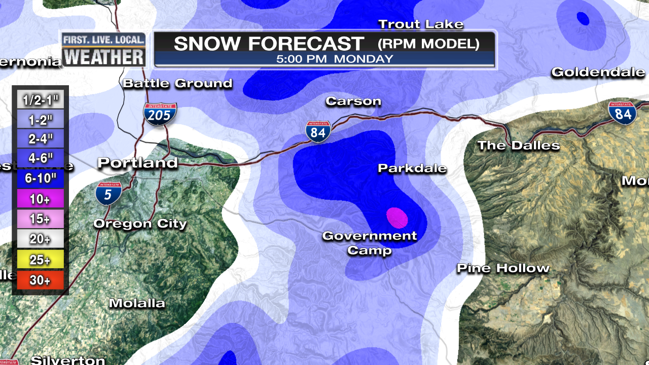
Things have been a bit "upside-down" the past 24 hours with warming in the mountains and the cold air locked in the Gorge and valleys west of the Cascades. For Monday morning things are back to normal (mostly) with the snow level lowering quickly behind a cold front down to around 1,000'. That plus a large area of showers moving onshore means a snowy day with the water content of the snow going downhill = good skiing! Another surge of snow arrives overnight Monday for a new layer of fresh powder Tuesday.

TOTAL SNOW ENDING MONDAY PM
Upper Bowl: 10"
Temps: 22-25 degrees all day
Long Range: This winter has been a cold one in the Cascades, totally different than the past three. I don't see any sign of a change in the next week. The 2nd half of this week should be mainly sunny with cold daytime temps keeping the snow in good shape. Next chance for snow is sometime over the coming weekend. There is still no sign of (shhh!) pineapple express type systems in the next 7+ days.
Follow the latest on Facebook: https://www.facebook.com/skibowl and Twitter here: https://twitter.com/skibowl