BEST SKI CONDITIONS OF THE WINTER ON THE WAY SUNDAY & MONDAY!
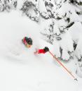
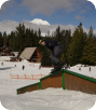
Those few days in late January with Upper Bowl open were magical; I happened to be up there the Friday evening right after the fresh snow was laid down. Then the dreaded upper-level ridge sent us warm temperatures, and rain took a toll on the snowpack. But the turnaround has begun and I see the snowiest pattern so far this winter ahead.
A typical "La Niña" weather pattern has finally kicked in with weather systems dropping in from the northwest. All of our long-range models show this much colder than normal setup continuing the next 10+ days (through the end of February). I think we have many feet of snow coming the 2nd half of February.
DETAILS
Snow levels rise to around Government Camp by midday Friday as snow intensity picks up. So expect 6-10" new snow on the ground by tomorrow evening, that's on top of the 8" that fell yesterday. Snow levels stay right around Govy (Skibowl Base) through midday Saturday, then they crash with moderate/heavy snow Saturday afternoon/evening. During that time another 6-12" should fall, mainly a wet snow.
Here's the big news: On Sunday, the snow level drops down into the lowlands of Oregon. That means dry powder snow in the mountains and temperatures only around 20 degrees. Models are generating 10" to 15" from Saturday evening through Sunday night.
Monday should be dry with a cold northerly wind. And I mean cold...temperatures linger between 12-20 degrees the entire day, the coldest ski day so far this season, but by that time 2 to 3 feet of fresh snow should have fallen.

Follow the latest on Facebook: https://www.facebook.com/skibowl and Twitter here: https://twitter.com/skibowl