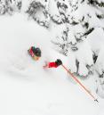
Wednesday is the one big fresh powder day this week!
10pm Monday...
Time to figure out how you're getting up to Skibowl Wednesday. A relatively mild storm dumps 2-3" snow at the base area Tuesday with a changeover to a mix by midday at the bottom and snow continuing up top. By sunset 5-8" new should be on the ground on top of Upper Bowl. After sunset, the snow level drops (to 3,000') and colder air works into the Cascades on strong west winds. That brings heavy & blowing snow through about sunrise Wednesday morning.
My forecast for total snow now through Wednesday 8am: 12" base and 20" on upper bowl
Our model tends to overdo the snow totals a bit, but you get the idea. If the pic doesn't show in your email then go to the web link

Long Range: Temperatures warm dramatically Thursday (rain possible) so Wednesday is definitely the day to hit the slopes. The next round of good snow shows up Friday and Saturday with cooler air. That cool airmass keeps the fresh snow in good shape through this coming weekend.
Follow the latest on Facebook: https://www.facebook.com/skibowl and Twitter here: https://twitter.com/skibowl