THIS POWDER ALERT IS FOR SATURDAY & SUNDAY (February 4th/5th)
Big Cascade Snow Returns This Weekend
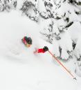
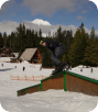
We've had lots of cold weather in the past month, and some snow at times. And luckily this winter we've only seen a big rain event ONCE! That's some good luck. Now we see our first big dumping of February coming up on Saturday and possibly Sunday as well. On Friday temperatures will be relatively warm with a rain/snow mix at Govy. But a cold front moves through the Cascades by lift-turning time Saturday AM. That means it'll be all snow Saturday. By Saturday night the snow level falls and it'll likely be down below 3,000', that gives us a better quality snow for night skiing.

TOTAL SNOW BY SUNDAY AM
Upper Bowl: 30"
Temps: 32-37 deg. Friday, 30-32 Saturday, 20s Saturday evening
Long Range: The good news? There's no sign of a pineapple express or warm system in the next week to 10 days. Sunday may or may not bring another big dumping of snow. Some models are taking more of that up north. If that system decides to sit right over us all day Sunday instead? That'll be one epic weekend with another foot of two of powder! Monday and Tuesday look colder with a drier powder and another foot or so. This winter keeps on giving...enjoy.
Follow the latest on Facebook: https://www.facebook.com/skibowl and Twitter here: https://twitter.com/skibowl